Advanced Excavator Control for Digital Construction
Challenges in excavation work
Complex projects demand more than traditional guidance. Large construction sites, infrastructure projects and multi-machine operations require precise coordination. Relying on stakes, manual surveys or 2D-only guidance slows down workflows and increases the risk of errors — especially when tasks must align with digital plans.
Difficulty managing changing elevations, designs and tolerances
Inefficiencies caused by manual stakeouts and repeated surveying
Lack of real-time alignment between machine work and project models
Multiple machines working without shared data or a unified workflow
Xsite® 3D
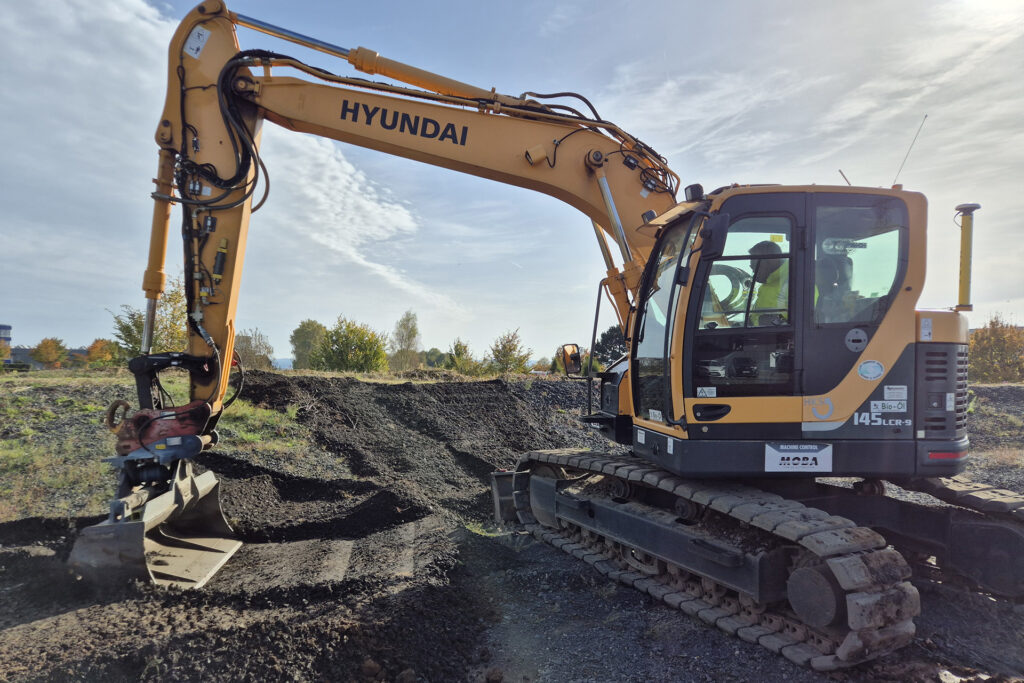
Full 3D awareness for efficient, model-based excavation
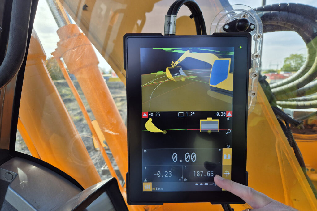
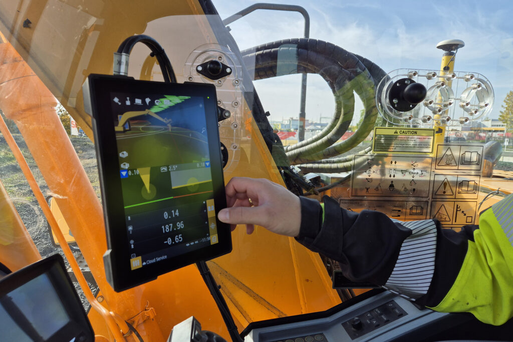
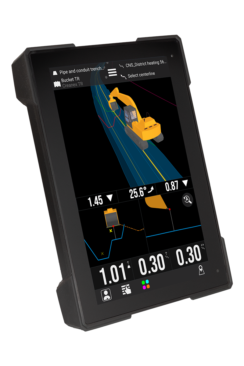
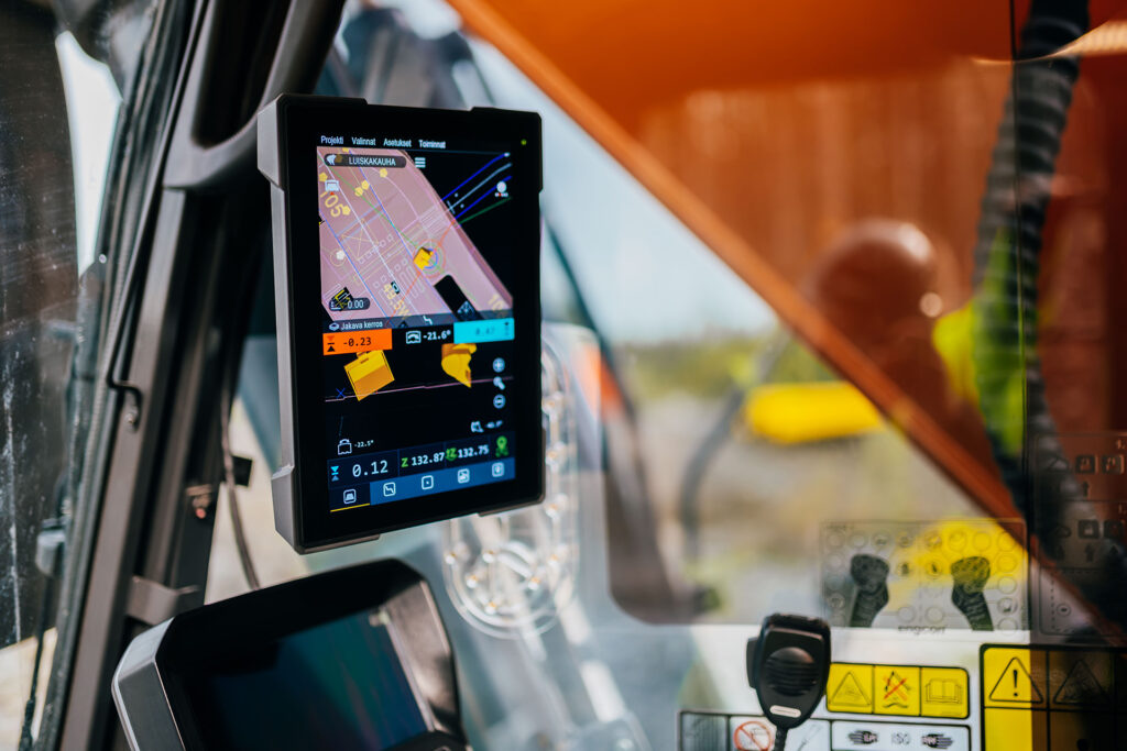
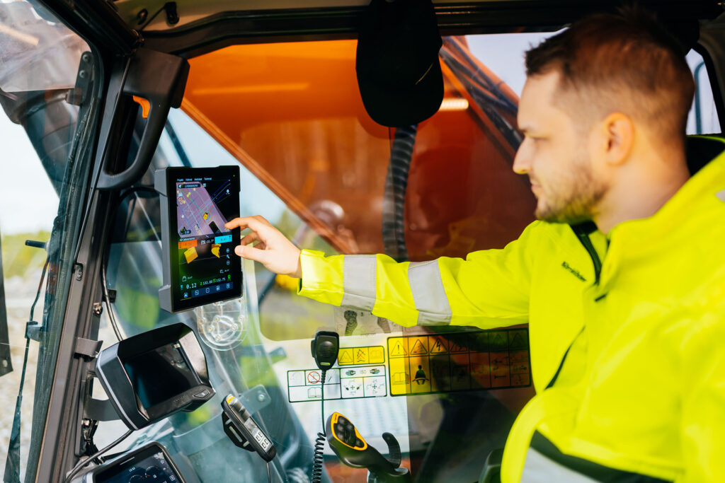
Xsite 3D gives operators complete visibility of the design model directly in the cabin. Using GNSS positioning, high-precision sensors and advanced software, the system shows the exact bucket location relative to the 3D plan — enabling accurate excavation, streamlined workflows and full integration into digital construction processes.
Where digital design meets real-world performance.
Xsite® 3D Application Areas
Designed for complex, large-scale construction projects
Road and highway construction
Large infrastructure projects
Rail and utility networks
Major earthworks and site preparation
Water management and drainage systems
Smart construction and BIM-driven workflows
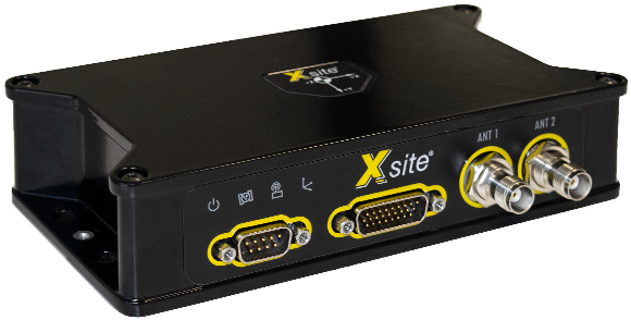
Xsite® 3D Features
Powerful 3D guidance for demanding projects
Xsite 3D combines advanced sensor technology with modern software to deliver a comprehensive, real-time view of the design model and excavation progress.
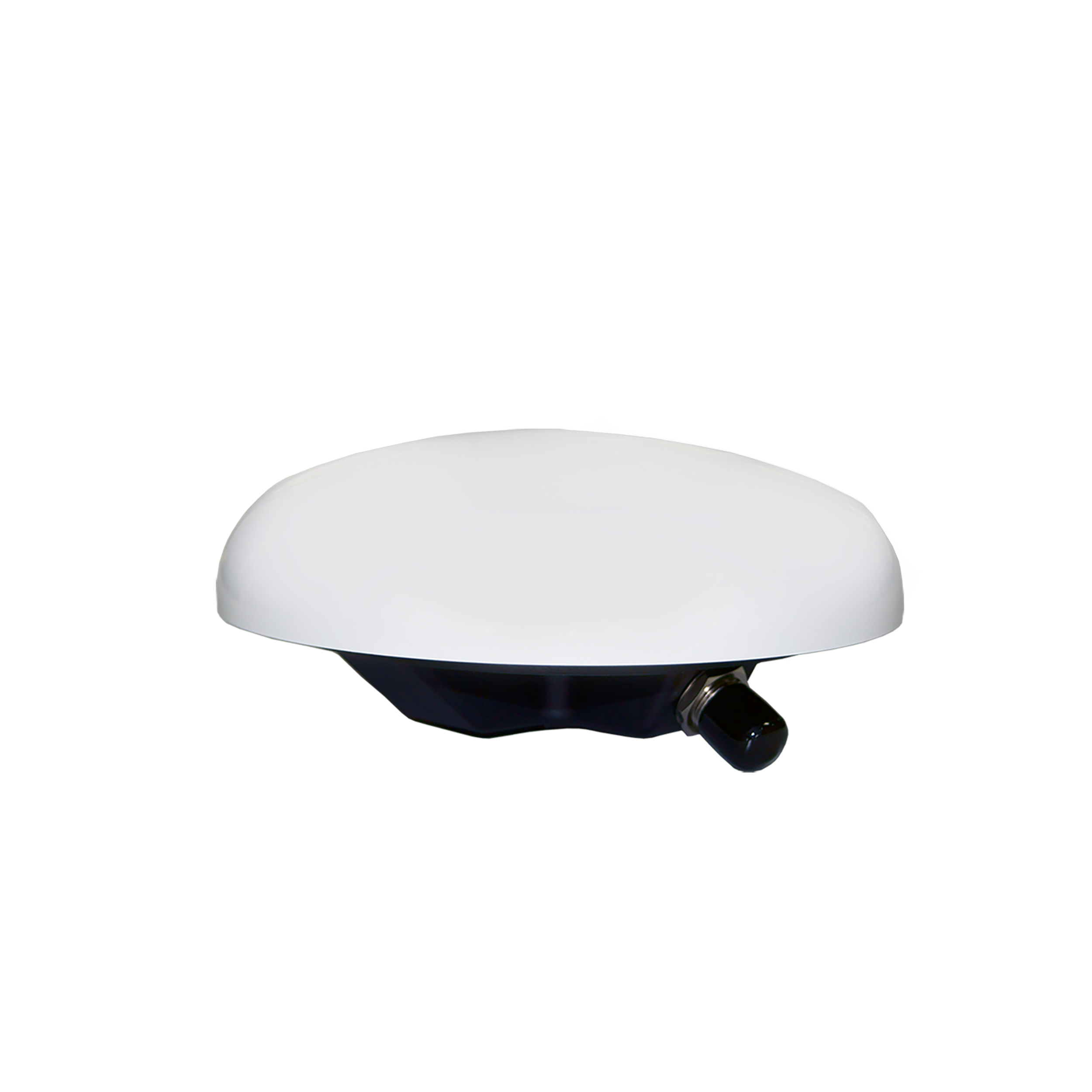
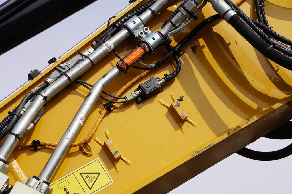
Using precise GNSS receivers and multi-axis sensors, Xsite 3D continuously calculates the excavator’s exact position within the design model. High-performance processors ensure the data is updated instantly, giving operators accurate, stable and predictable control — even on large, technically demanding jobsites.
GNSS-based 3D positioning
Accurate real-time location of the bucket, boom and stick within the digital terrain model.
Full model visualization
View cross-sections, alignments, surfaces and design layers directly on the display.
Flexible import formats
Works with common industry-standard 3D formats for seamless integration.
Intuitive touchscreen interface
High-resolution display designed for clear interpretation of complex models.
Live progress tracking
Monitor cut/fill, slopes, depths and design alignment instantly.
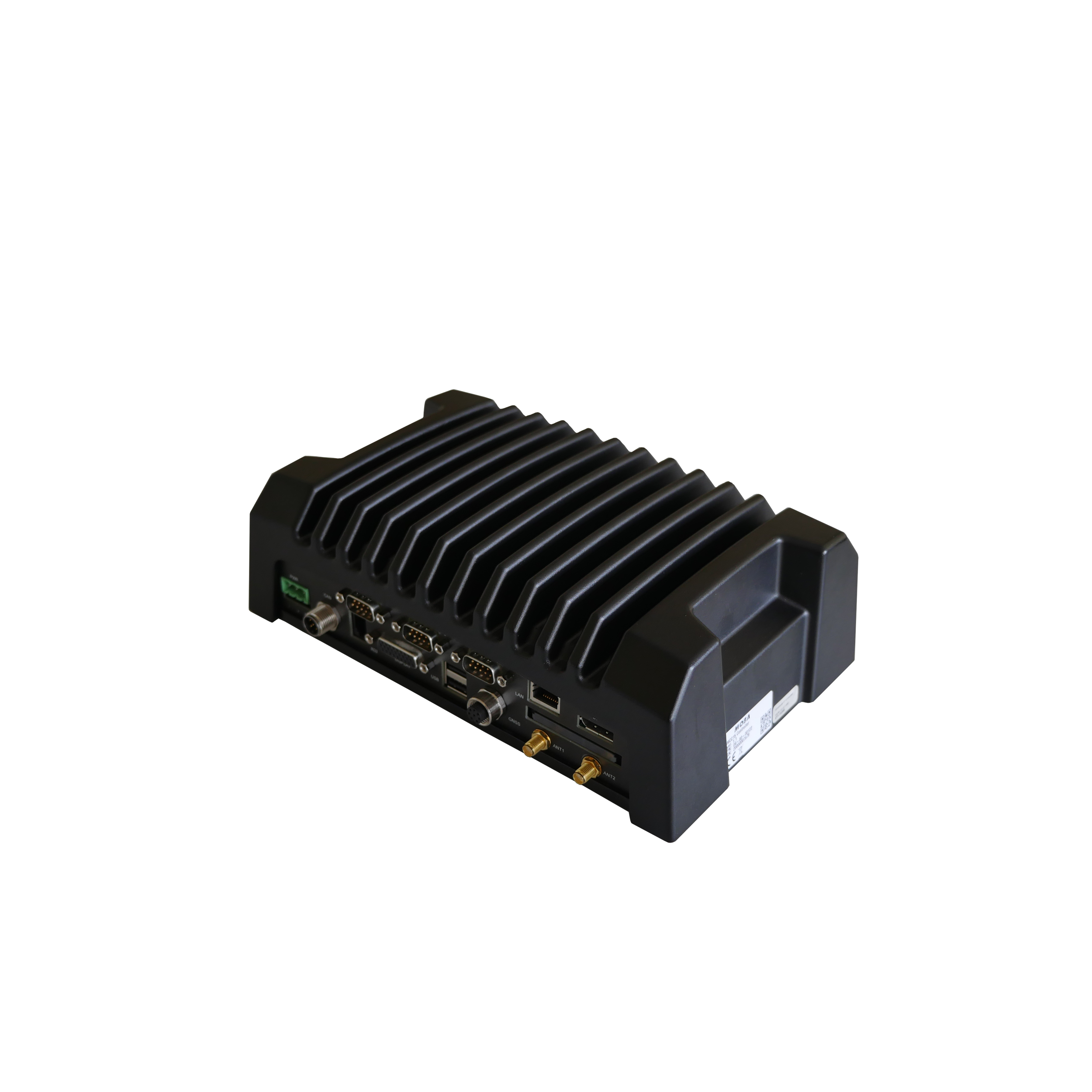
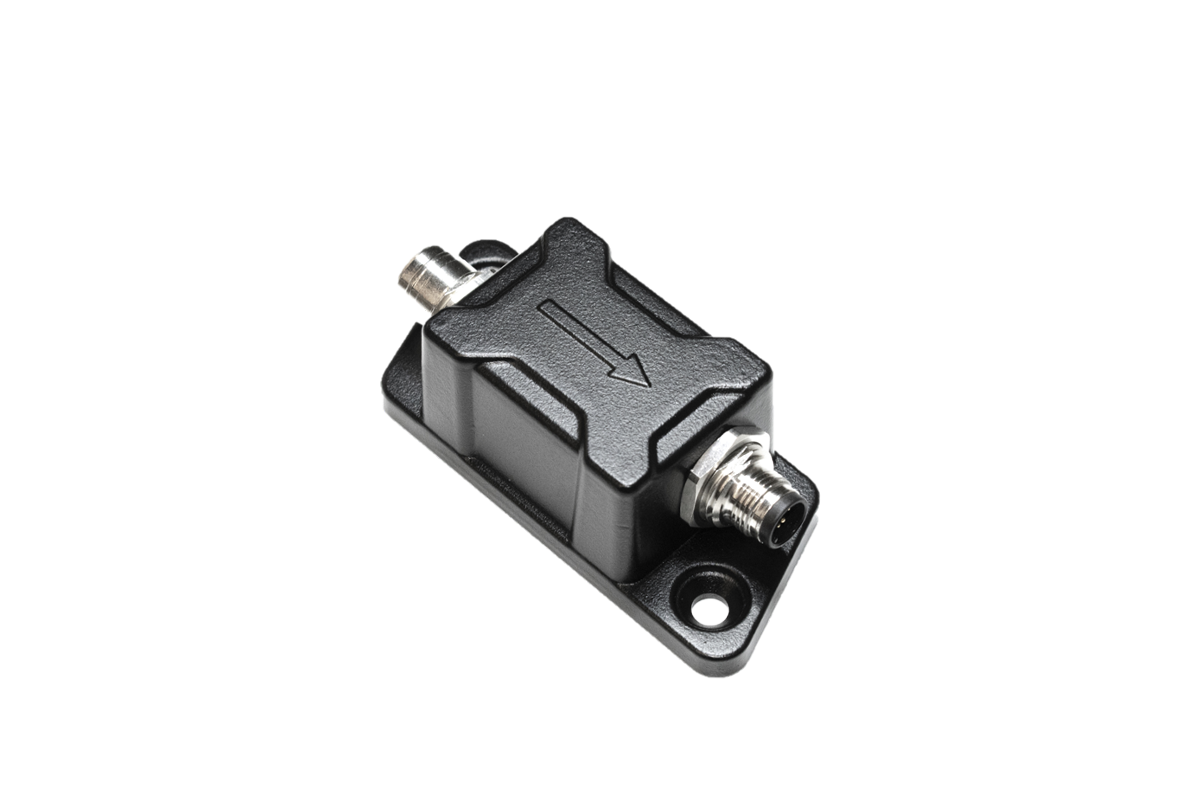
Robust hardware platform
Rugged components and CAN communication built for long-term reliability.
Get the most out of your machines with MOBA systems
Do you have questions about our solutions? We are ready to help you!
In addition to our headquarters in Germany, MOBA is represented by its subsidiaries in Europe, USA, South America, India, Asia and Australia, and by a worldwide dealer network in all key markets in the sectors it serves.